
Advanced Analytic Methods in Geospatial Intelligence
Resource Description
General James Clapper, former United States Director of National Intelligence and the National Geospatial-Intelligence Agency (NGA), once said "everything happens somewhere." He stressed that there are aspects of time and place to every intelligence problem. In this course, you will examine how time and place work with general intelligence techniques to create geospatial intelligence. You will learn and apply critical thinking skills, structured analytical techniques, and other intelligence methods in a geospatial context. You'll also learn how to reduce personal and organizational bias by conducting an Analysis of Competing Hypotheses, by R. Heuer, a 45-year veteran of the CIA. As a result, you will be better prepared for the world of geospatial intelligence analysis.
Learn moreAdvanced Python Programming for GIS
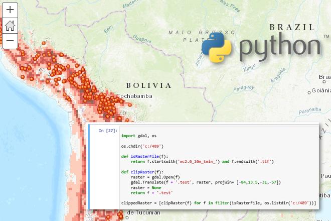
Credit: Jan Oliver Wallgrun, © Penn State University, (CC BY-NC-SA 4.0)
Resource Description
In GEOG 489, you will learn advanced applications of Python for developing and customizing GIS software, designing user interfaces, solving complex geoprocessing tasks, and leveraging open source. The course consists of readings, walkthroughs, projects, quizzes, and discussions about advanced GIS programming concepts and techniques, and a final term project. It complements the material covered in GEOG 485: GIS Programming and Customization. Software covered in the course includes: Esri ArcGIS Pro/arcpy, Jupyter Notebook, Esri ArcGIS API for Python, QGIS, GDAL/OGR. Students will also make use of the Git version control software for code management, and learn techniques for distributing Python applications to end users. Learn moreCartography and Visualization
Resource Description
Maps are powerful visual tools, both for communicating ideas and for facilitating data exploration. In GEOG 486: Cartography and Visualization, you will learn design principles and techniques for creating maps with contemporary mapping tools, including ArcGIS Pro. In this lab-focused course, you’ll apply cartographic theory to practical problems, with a focus on design decisions such as selecting visual variables, classifying and generalizing data, applying principles of color and contrast, and choosing projections for maps. You will also be introduced to future-focused application topics such as augmented and virtual reality, mapping with multivariate glyphs, the visual depiction of uncertainty, interactive geovisualizations and (geo)visual analytics, and decision-making with maps and mapping products. Successful completion of this course will signify mastery in map production for communication and research; you will be practiced in making, analyzing, critiquing, and sharing high-quality maps. Learn moreChallenges in Global Geospatial Analytics

Credit: People Walking Beside Baggage Hall and Arrivals Hall Signage by Skitterphoto is licensed under CC0
Resource Description
How would you like to travel to new places while collaborating on a geospatial data challenge with students from around the world? In this class, students collaborate on a global-scale geospatial analysis problem with a focus on data analytics and professional practice in Geographic Information Systems. Penn State MGIS students collaborate with graduate students from ITC - University of Twente in Enschede, Netherlands to develop solutions to analyze spatio-temporal patterns in refugee migration data. Students have the opportunity to present their work and develop new connections with EU geospatial professionals via site visits to European national mapping agencies. Students work in teams to use geospatial analytics to arrive at a solution to visualize patterns over space and time. Learn moreCloud and Server GIS

Credit: Binary One Cyborg Cybernetics-2302728 by Gerd Altmann is licensed under CC0
Resource Description
Is your understanding of Cloud GIS a bit hazy? Does thinking about it leave you in a fog? We've designed GEOG 865, Cloud and Server GIS, to help you understand how all of the various pieces of architecture fit together. By the end of the class you'll have a clear understanding of esri's and others' offerings in the space, how to implement ArcGIS Enterprise on Amazon EC2, make online maps with Carto and Mapbox, and engage in some blue sky thinking of your own in our weekly discussions about trends and directions. Learn moreEnergy Industry Applications of GIS
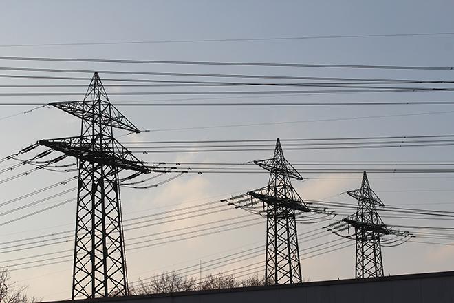
Credit: Stormast by Inactive account 127071 is licensed under CC0
Resource Description
Is Energy and GIS your passion? If so, Energy Industry Applications of GIS provides students with an in-depth exploration of the complexities of siting decisions in the electricity market. The course introduces a variety of siting challenges that confront the energy industry and its customers and neighbors but focuses on the siting of electrical transmission lines. The course also provides hands-on experience with a common decision support technology, ArcGIS, and considers how the technology may be used to facilitate public participation in siting decisions. This course stopped being offered for credit and may be out of date or have broken links after May 2019. Learn moreEnergy Policy

Credit: Purple Flowers by winterseitler is licensed under CC0
Resource Description
Energy policy sits at the crossroads of science and policy. And now, energy and climate policy are inextricably linked; the policies we choose have very real consequences for our climate. This intersection of science and policy is chaotic and bustles with activity motivated by various competing (and conflicting) interests and factors. We must understand the motivations driving them and bridge the divides between our reliance on fossil fuels and our need to transition to less carbon-intensive and renewable alternatives. While the science and math behind these problems is often fairly straightforward, the politics and behavioral changes are not. Come stand at this busy intersection with us as we navigate toward progressive climate policy alternatives at all scales of governance! Learn moreEnvironment and Society in a Changing World
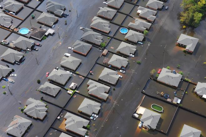
Credit: Ariel view of a flooded neighborhood near New Orleans by Petty Officer 1st Class Matthew Schofield is Public Domain
Resource Description
What factors lead to a natural disaster? What causes a famine? Why do cities flood? According to a recent article in The Atlantic, Houston's flooding during the 2017 Hurricane Harvey was primarily caused by impervious pavement which prevents the absorption of water into the land. This example illustrates how nature and society are interlinked, which is the main focus of Geography 30, Penn State's introductory course to nature-society geography. In addition to examining the linkages between human development and natural hazards, this course will also explore human society's connection to food systems, climate change, urbanization and biodiversity. The course will also cover topics of ethics and decision making in order to help students evaluate the tradeoffs of these interconnections. Learn moreEnvironmental Challenges in Spatial Data Science
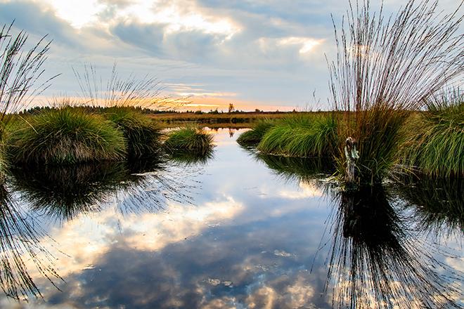
Credit: Moor Swamp Landscape Nature Nature Reserve by herbert2512 is licensed under CC0
Resource Description
Increasingly volatile climate and weather; vulnerable drinking water supplies; shrinking wildlife habitats; widespread deforestation due to energy and food production. These are examples of environmental challenges that are of critical importance in our world, both in far away places and close to home, and are particularly well suited to inquiry using geographic information systems. In GEOG 487 you will explore topics like these and learn about data and spatial analysis techniques commonly employed in environmental applications. After taking this course you will be equipped with relevant analytical approaches and tools that you can readily apply to your own environmental contexts. Learn moreExploring Imagery and Elevation Data in GIS Applications
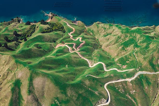
Credit: D'Urville Island, New Zealand by Alex Siale is free to use