
Exploring Imagery and Elevation Data in GIS Applications

Credit: D'Urville Island, New Zealand by Alex Siale is free to use
Resource Description
“Exploring Imagery and Elevation Data in GIS Applications” (GEOG 480) focuses on the use of remotely sensed imagery and elevation data in GIS applications. Students enrolling in GEOG 480 should have a solid conceptual foundation in geospatial information science and technology. GEOG 480 is appropriate for those who are already working in the geospatial profession and wish to use imagery and elevation data in visualization and spatial analysis. Throughout the course, students confront realistic remote sensing problem scenarios that incorporate such skills and concepts as definition of data needs, metadata content standards, data formats and types, and analysis methods. Learn moreGeographic Foundations of Geospatial Intelligence

Credit: Group of People Enjoying Music Concert by Leah Kelley is free to use
Resource Description
A good detective or researcher like Sherlock Holmes knows the fundamental questions that need to be answered to gather facts to solve a problem. So how does geospatial intelligence contribute to answering these questions? While geospatial technology is useful in revealing who, what, when, and where events take place, it is less useful in explaining why events occur. However, geospatial intelligence analysis leverages geographic information science and technology with the intelligence tradecraft to develop products that support decision-making in national and homeland security, law enforcement, emergency management, and international relief efforts. GEOG 882 will challenge you to think critically, consider alternative viewpoints, and question your own assumptions when analyzing why human events occur over place and time. Learn moreLocation Intelligence for Business
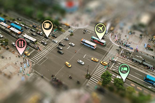
Credit: Aerial Photography of Cars on Road-intersection 186537/ by Joey Lu is licensed under CC0 | location pins added to original
Resource Description
Do you enjoy the competitive challenge of starting up a new business or expanding into new areas? Are you involved in economic and community development? Are you considering the best place to work and live? Do you like to gain an advantage? Location Intelligence for Business extends the application of geospatial intelligence analytical methods to the business world for competitive advantage. You will have an opportunity to understand and apply location technologies, geospatial analysis, and business geography (demographics and psychographics) to support competitive business decision-making. You will uncover and explore the key geospatial principles involved in site selection, market analysis, risk and crisis management, logistics, and transportation by solving those problems with available geospatial tools and data. Learn moreMaking Maps that Matter with GIS
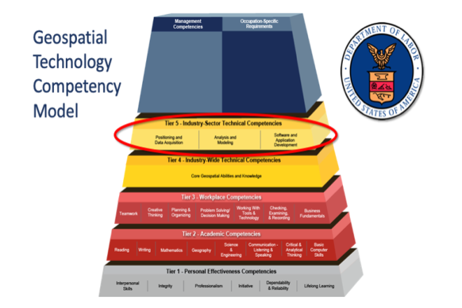
Credit: US Department of Labor Employment & Training Administration - Used with Permission