Advanced Python Programming for GIS
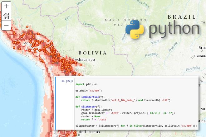
Credit: Jan Oliver Wallgrun, © Penn State University, (CC BY-NC-SA 4.0)
Resource Description
In GEOG 489, you will learn advanced applications of Python for developing and customizing GIS software, designing user interfaces, solving complex geoprocessing tasks, and leveraging open source. The course consists of readings, walkthroughs, projects, quizzes, and discussions about advanced GIS programming concepts and techniques, and a final term project. It complements the material covered in GEOG 485: GIS Programming and Customization. Software covered in the course includes: Esri ArcGIS Pro/arcpy, Jupyter Notebook, Esri ArcGIS API for Python, QGIS, GDAL/OGR. Students will also make use of the Git version control software for code management, and learn techniques for distributing Python applications to end users. Learn moreCartography and Visualization
Resource Description
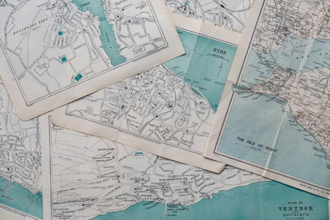
Maps are powerful visual tools, both for communicating ideas and for facilitating data exploration. In GEOG 486: Cartography and Visualization, you will learn design principles and techniques for creating maps with contemporary mapping tools, including ArcGIS Pro. In this lab-focused course, you’ll apply cartographic theory to practical problems, with a focus on design decisions such as selecting visual variables, classifying and generalizing data, applying principles of color and contrast, and choosing projections for maps. You will also be introduced to future-focused application topics such as augmented and virtual reality, mapping with multivariate glyphs, the visual depiction of uncertainty, interactive geovisualizations and (geo)visual analytics, and decision-making with maps and mapping products. Successful completion of this course will signify mastery in map production for communication and research; you will be practiced in making, analyzing, critiquing, and sharing high-quality maps. Learn moreCloud and Server GIS

Credit: Binary One Cyborg Cybernetics-2302728 by Gerd Altmann is licensed under CC0
Resource Description
Is your understanding of Cloud GIS a bit hazy? Does thinking about it leave you in a fog? We've designed GEOG 865, Cloud and Server GIS, to help you understand how all of the various pieces of architecture fit together. By the end of the class you'll have a clear understanding of esri's and others' offerings in the space, how to implement ArcGIS Enterprise on Amazon EC2, make online maps with Carto and Mapbox, and engage in some blue sky thinking of your own in our weekly discussions about trends and directions. Learn moreGIS Programming and Software Development

Credit: High Angle View of Residential Buildings by Palo Cech is free to use
Resource Description
Bill Gates is credited with saying he would "hire a lazy person to do a difficult job" with the justification that "a lazy person will find an easy way to do it." GEOG 485 doesn't teach the lazy way to get the job done, but it does teach the scripting way — which is arguably even better. You've probably heard the "give a fish"/"teach to fish" saying? That's the gist of GEOG 485: to equip you, in an ArcGIS context, with the ModelBuilder and Python scripting skills to make your boring, repetitive geoprocessing tasks easier, quicker and automatic — so you can focus on the more interesting (potentially more valuable) work that you (and your employers) really want you to be doing. Learn moreOpen Web Mapping
Credit: The Activities of Africa by Mariusz Prusaczyk is licensed under CC0
Resource Description
Everyone can make a web map now, but what are the best tools to do so? Maybe you have already created web maps with ArcGIS or Google Maps but never taken time to have a closer look at open source software alternatives such as QGIS, GeoServer and Leaflet? Or, are you new to web mapping and looking for the best way to create a web application for spatial data from your job or hobby? If so, GEOG 585, Open Web Mapping, is the right course for you. Learn about FOSS vs. proprietary GIS software, open data and standards for web mapping, and how to create beautiful and interactive web maps with Javascript and Leaflet. Learn moreSpatial Database Management
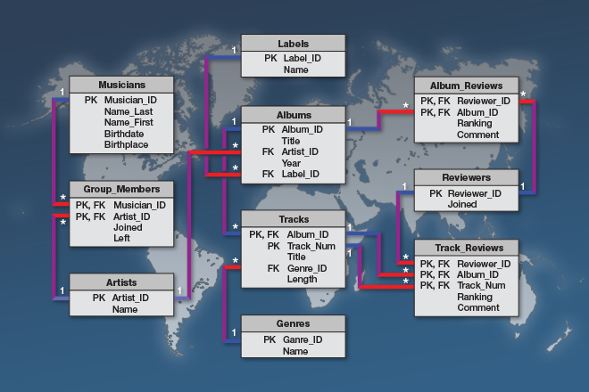
Credit: © Penn State University is licensed under CC BY-NC-SA 4.0
Resource Description
A spatial database is the backbone of a successful organization or website that depends upon maintaining and using data pertinent to locations on Earth. In GEOG 868, Spatial Database Management, capabilities specific to Relational Database Management Systems (RDBMS) and Geographic Information Systems (GIS) are combined to teach students to create, maintain, and query spatial databases in both desktop and enterprise environments. Learn the basics of Standard Query Language (SQL) and database design/normalization, the specifics of managing spatial data in an open-source technologies context (Postgres/PostGIS) and in the context of the Esri geodatabase. Along the way, you will become familiar with spatial functions and versioning, the latter in a server environment hosted by Amazon Web Services. Learn moreWeb Application Development for the Geospatial Professional
Credit: Ipad, Map, Tablet, Internet, Screen by FirmBee is licensed under CC0

