
Making Maps that Matter with GIS
Credit: US Department of Labor Employment & Training Administration - Used with Permission
Resource Description
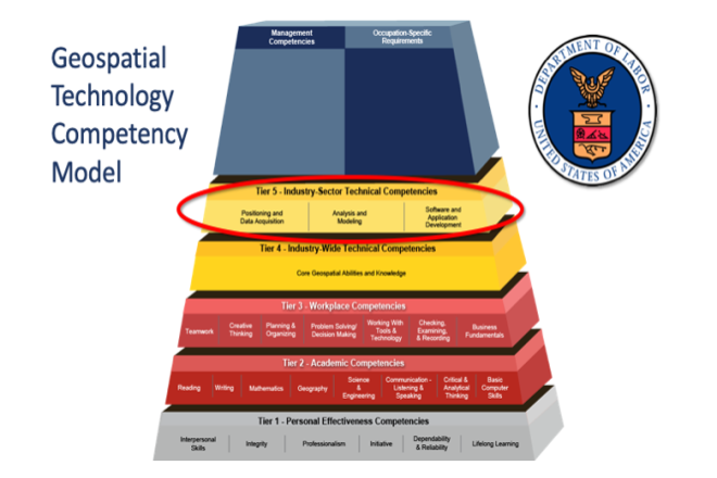
This open courseware consists of eight videos from the gateway course to Penn State's Certificate and Masters degree programs in GIS. Following an introduction entitled “Why GIS Matters," six case studies correspond to the three sectors of the U.S. Department of Labor’s Geospatial Technology Industry: 1. Positioning and Data Acquisition (“GIS and the Eradication of Polio in Nigeria” and "A Global Geodetic Reference Frame for Sustainable Development”) 2. Analysis and Modeling (“Everyday Spatial Analysis” and “A National Water Model for Flood Prediction and Response”) 3. Software and App Development (“Rediscovering GIS” and “Building a Web GIS Business) The concluding video "Will GIS Matter in the Internet of Things?” considers the future of GIS technology and prospects for GIS people. Making Maps that Matter with GIS Video Playlist Learn moreMapping our Changing World

Credit: Space Station Flyover of Super Typhoon Noru by NASA is Public Domain