
Geographic Information Analysis
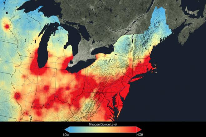
Credit: Close up of nitrogen dioxide in the Northeast U.S. averaged over 2005 by NASA is free to use.
Resource Description
In this data rich world, we need to understand how things are organized on the Earth's surface. Those things are represented by spatial data and necessarily depend upon what surrounds them. Spatial statistics provide insights into explaining processes that create patterns in spatial data. In geographical information analysis, spatial statistics such as point pattern analysis, spatial autocorrelation, and spatial interpolation will analyze the spatial patterns, spatial processes, and spatial association that characterize spatial data. Understanding spatial analysis will help you realize what makes spatial data special and why spatial analysis reveals a truth about spatial data. Learn moreMapping our Changing World
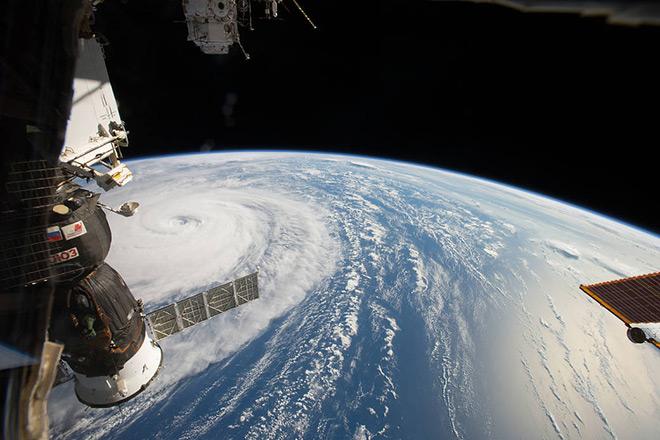
Credit: Space Station Flyover of Super Typhoon Noru by NASA is Public Domain