
Environment and Society in a Changing World
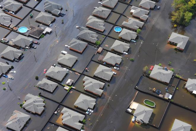
Credit: Ariel view of a flooded neighborhood near New Orleans by Petty Officer 1st Class Matthew Schofield is Public Domain
Resource Description
What factors lead to a natural disaster? What causes a famine? Why do cities flood? According to a recent article in The Atlantic, Houston's flooding during the 2017 Hurricane Harvey was primarily caused by impervious pavement which prevents the absorption of water into the land. This example illustrates how nature and society are interlinked, which is the main focus of Geography 30, Penn State's introductory course to nature-society geography. In addition to examining the linkages between human development and natural hazards, this course will also explore human society's connection to food systems, climate change, urbanization and biodiversity. The course will also cover topics of ethics and decision making in order to help students evaluate the tradeoffs of these interconnections. Learn moreGeospatial Intelligence and the Geospatial Revolution
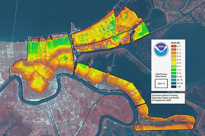
Credit: LIDAR map of New Orleans flooding caused by Hurricane Katrina, 3 September 2005 from ESA/NOAA is licensed under CC BY-SA 3.0 IGO
Resource Description
Geographic Intelligence (GEOINT) is more than people working with computers in a secure intelligence facility. Join us for this exciting journey to learn about GEOINT's application in business, law enforcement, and defense. Advances in satellites, GPS, unmanned aerial systems, wireless communications, handheld computing, and the ability to automate laborious map analysis processes has transformed what used to be called geographic intelligence, or GEOINT, and the nature of the insights provided to managers and leaders. We have gone from mountains of hardcopy maps to amazing automated systems that provide previously unavailable understanding. GEOINT combines geographic information science and technologies with an analytic tradecraft. You will experience the value of GEOINT. We welcome you to the Revolution. Learn moreMaps and the Geospatial Revolution
Credit: A. Robinson © Penn State University is licensed under CC BY-NC-SA 4.0