
Linear Programming: Lecture Notes
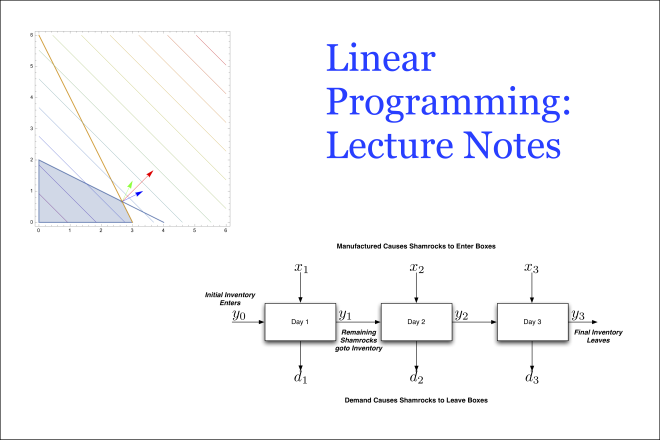
Credit: Image adapted from figures by Christopher Griffin and is licensed under CC BY-NC-SA 3.0 US
Resource Description
This is a set of lecture notes for Penn State’s undergraduate Linear Programming course.
The lecture notes are (roughly) based on the first 6 chapters of Bazaraa et al.’s Linear Programming and Network Flows book. This is a reasonably good book, written primarily by and for Industrial Engineers. However, it does not present major results in the standard theorem-proof style common to mathematical discourse. This set of notes corrects this situation by presenting the material in a format for presentation to a mathematics class.
Many of the proofs in this set of notes are adapted from the textbook with some minor additions. Additionally, I prefer to present maximization problems, while Linear Programming and Network Flows prefers the minimization format. I’ve modified all the proofs to operate on maximization problems. When used with the book, the student can obtain a complete set of proofs for elementary Linear Programming.
Location Intelligence for Business
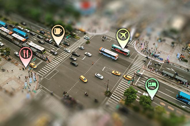
Credit: Aerial Photography of Cars on Road-intersection 186537/ by Joey Lu is licensed under CC0 | location pins added to original
Resource Description
Do you enjoy the competitive challenge of starting up a new business or expanding into new areas? Are you involved in economic and community development? Are you considering the best place to work and live? Do you like to gain an advantage? Location Intelligence for Business extends the application of geospatial intelligence analytical methods to the business world for competitive advantage. You will have an opportunity to understand and apply location technologies, geospatial analysis, and business geography (demographics and psychographics) to support competitive business decision-making. You will uncover and explore the key geospatial principles involved in site selection, market analysis, risk and crisis management, logistics, and transportation by solving those problems with available geospatial tools and data.Making Maps that Matter with GIS
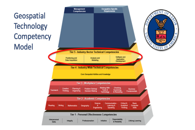
Credit: US Department of Labor Employment & Training Administration - Used with Permission
Resource Description
This open courseware consists of eight videos from the gateway course to Penn State's Certificate and Masters degree programs in GIS. Following an introduction entitled “Why GIS Matters," six case studies correspond to the three sectors of the U.S. Department of Labor’s Geospatial Technology Industry: 1. Positioning and Data Acquisition (“GIS and the Eradication of Polio in Nigeria” and "A Global Geodetic Reference Frame for Sustainable Development”) 2. Analysis and Modeling (“Everyday Spatial Analysis” and “A National Water Model for Flood Prediction and Response”) 3. Software and App Development (“Rediscovering GIS” and “Building a Web GIS Business) The concluding video "Will GIS Matter in the Internet of Things?” considers the future of GIS technology and prospects for GIS people. Making Maps that Matter with GIS Video PlaylistMapping our Changing World
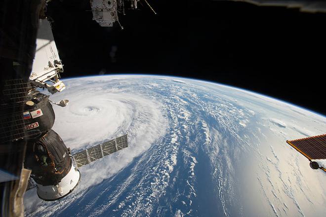
Credit: Space Station Flyover of Super Typhoon Noru by NASA is Public Domain
Resource Description
Whether you realize it or not, when you carry a smart phone, use a navigation system in your car, or look up the nearest coffee shop on your computer, you are using geographic information. Geographic data and technologies are embedded in almost all aspects of our lives. GEOG 160, Mapping Our Changing World, explores what geographic information and data are, what makes them unique, how they are created, and how we use them. You'll explore how geographic technologies like geographic information systems (GIS), remote sensing from satellites, and global positioning systems (GPS) work together to provide us with information we rely on. You'll also become an informed consumer of the geographic content in your life.Maps and the Geospatial Revolution
Credit: A. Robinson © Penn State University is licensed under CC BY-NC-SA 4.0
Resource Description
The past decade has seen an explosion of new mechanisms for understanding and using location information in widely-accessible technologies. This Geospatial Revolution has resulted in the development of consumer GPS tools, interactive web maps, and location-aware mobile devices. This course brings together core concepts in cartography, geographic information systems, and spatial thinking with real-world examples to provide the fundamentals necessary to engage with Geographic Information Science. We explore what makes spatial information special, how spatial data is created, how spatial analysis is conducted, and how to design maps so that they're effective at telling the stories we wish to share. To gain experience using this knowledge, we work with the latest mapping and analysis software to explore geographic problems.Materials in Today's World

Credit: James Webb Space Telescope Mirror 37 by NASA/MSFC/David Higginbotham/Emmett Given is Public domain
Resource Description
What materials have you touched today? In today's society, virtually every segment of our personal and professional lives is influenced by the limitations, availability, and economic considerations of the materials used. Through readings and science documentaries, this course will show you how and why certain materials are selected for different applications and how the processing, structure, properties, and performance of materials are intrinsically linked. You will be introduced to the basic science and technology of materials, how the world has been shaped by materials, and how knowledge of materials can be used to understand modern materials and the development of new ones.Mechanics Map Digital Textbook
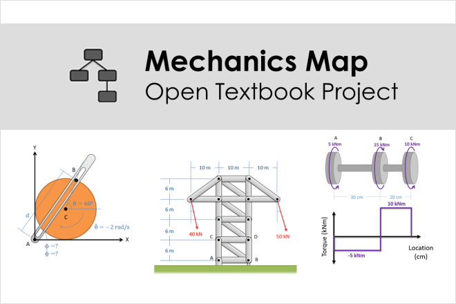
Images from the Mechanics Map Digital Textbook are licensed under CC BY-SA 4.0
Resource Description
The Mechanics Map is an open textbook for engineering statics and dynamics containing written explanations, video lectures, worked examples, and homework problems.
The Mechanics Map Digital Textbook Project is an open digital textbook founded on the idea that expert-generated concept maps can serve as a powerful advance organizer for textbook content. The overview at the beginning of each chapter consists of a video showing how all the topics in the chapter are linked together by the author. By providing this overview, the author is seeking to help users organize the knowledge they are developing in a way that matches the expert's organization of knowledge.
Dr. Moore has been assisted by Dr. Majid Chatsaz at Penn State Scranton, Dr. Agnes d'Entremont at The University of British Columbia, Joan Kowalski at Penn State New Kensington, and Dr. Douglas Miller at Penn State Dubois.
Modernism’s Monsters

Resource Description
The modern era is full of fears. The more we know about our world, the more frightening it can be, and the 1950s were a time in which the threat of nuclear war, fears of communist takeovers, and new advances in science were all combining to make the modern world a very frightening place. This fear was reflected in art and in popular culture, particularly in inexpensive B-movie science fiction films. This module explores some of that fear, and the artistic and popular works inspired by it. Watch out for the giant ants!
Modernity Unmoored: Ships as Material and Metaphor
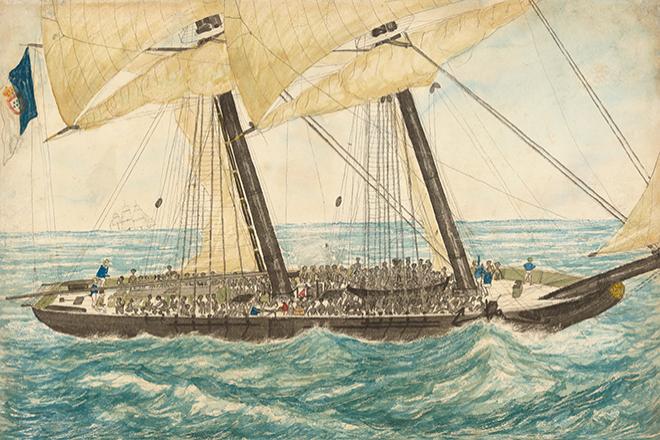
Credit: Lieutenant Henry Samuel Hawker, The Portuguese slaver Diligenté captured by H.M. Sloop Pearl with 600 slaves on board, taken in charge to Nassau, May 1838. Collection of the Smithsonian National Museum of African American History and Culture.
Resource Description
This series of modules approaches ‘ships’ and ‘boats’ as material and metaphor for thinking about migratory experiences and the movement of peoples, goods, and commodities, as they relate to the idea of modernity on a local, transnational, and planetary scale. The modules focus on literary, visual, and cinematic representations of ships and boats as a basis for engaging in comparative work. Ships and boats are considered not just as physical objects, but as technologies and symbolic objects that speak to the dynamics of circulation and/or extraction in the context of slavery, colonialism, and global capitalism. The modules underscore the role they have played in the establishment and subversion of racial, cultural, economic, and political divides across space and time.
National Parks in a Comparative Perspective
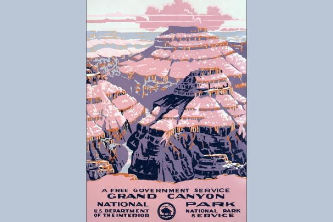
"Grand Canyon National Park, a free government service" (1938) poster by Chester Don Powell is public domain
Resource Description
This module invites a comparative and global emphasis in a study of national parks in USA and India. The universal quest for conservation and preservation varies in its motivation and is inevitably influenced by local histories and culture. The two sections of the module focused on the United States and India respectively bring the separate trajectories in view. In bringing a critical perspective on analyzing national parks, the module will not only look at aspirations for preserving heritage, but also see the parks as geographical and social spaces with conflicts. Conflicts between communities and flora and fauna will be a primary theme of analysis.