
From Meteorology to Mitigation: Understanding Global Warming

Credit: Blue Icebergs Under Cloudy Sky by Pixabay is licensed under CC0
Resource Description
Human-caused climate change represents one of the great environmental challenges of our time. As it is inextricably linked with issues of energy policy, a familiarity with the fundamentals of climate change is critical for those looking to careers in the energy field. To appreciate the societal, environmental, and economic implications of policies governing greenhouse gas emissions, one must understand the basic underlying science. METEO 469 serves to lay down the fundamental scientific principles behind climate change and global warming. A firm grounding in the science is then used as a launching point for exploring issues involving climate change impacts and mitigation.Fundamentals of Atmospheric Science
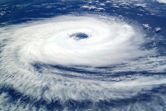
Credit: Cyclone Catarina by The Earth Observations Laboratory, Johnson Space Center, NASA is Public Domain
Resource Description
Do you want to know more about atmospheric science? This course is designed to give both Meteorology and non-Meteorology students a comprehensive understanding of atmospheric science and the quantitative analytical tools to apply atmospheric science to their own disciplines. Students are introduced to fundamental concepts and applications of atmospheric thermodynamics, radiative transfer, atmospheric chemistry, cloud microphysics, atmospheric dynamics, and the atmospheric boundary layer. These topics are covered broadly but in enough depth to introduce students to the methods atmospheric scientists use to describe and predict atmospheric phenomena. The course is designed to be taken by sophomore meteorology students as well as by students in related disciplines who have an adequate mathematical and physical background.Game Theory: Lecture Notes
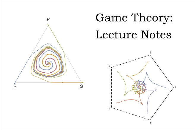
Credit: Image adapted from figures by Christopher Griffin and is licensed under CC BY-NC-SA 3.0 US
Resource Description
This is version two of a set of lecture notes for MATH 486, Penn State's undergraduate Game Theory course. Game Theory is the study of decision making under competition. The first truly mathematical study of Game Theory was initiated by Von Neumann and Morgenstern. John Nash (of A Beautiful Mind fame) added substantially to the field with his proof of the existence of equilibrium solutions for general sum games. Since then many mathematicians, economists, engineers and others have made substantial contributions to the study of games.
The lecture notes are loosely based on Luce and Raiffa's Games and Decisions: Introduction and Critical Survey. This is the same book John Nash used when he taught (or so I've heard). There are elements from Myerson's book on Game Theory (more appropriate for economists) as well as Morris' book on Game Theory. Naturally, I've also included elements from Von Neuman and Morgenstern's classic tome.
Geo-Resource Evaluation and Investment Analysis

Credit: Port Arthur Texas by user:12019 is licensed under CC0
Resource Description
We often face investment decisions, whether in our personal lives or our jobs. Investment projects involve payments at different times in a project's life. Capital costs are usually paid at early stages, but revenue is generated in the future. Time affects the value of money, and these values can't be compared directly. In EME 460, Geo-Resources Evaluation and Investment Analysis, we will learn methods to evaluate investment projects. The objective of the course is to ensure students learn the techniques used in geo-resource project evaluation, cash flow, net present value, and rate of return analysis; benefit cost ratio and payback period; interest rate and break even calculations; tax considerations, mutually exclusive projects evaluation, uncertainty and risks, depreciation, and loan calculations.Geodesign History, Theory, Principles
Photo credit: Filip Linders, MSF/Doctors Without Borders/Swedish Innovation Unit (used with permission)
Resource Description
Do you believe that we can be more creative in planning our communities and protecting environments for a sustainable future? Would you like to learn a method to make a difference? One that empowers stakeholders and reduces conflict? Geodesign delivers creative solutions for environmental, economic, and social issues. This method works collaboratively across disciplines, deploying innovative technology to dynamically illustrate the impacts of alternative design scenarios. Geodesign is rooted in the physical design professions coupled with social and geographic sciences and enhanced by the latest technologies. GEODZ 511 introduces students to the multifaceted, well-proven geodesign framework grounded in a series of key decision-making steps. It emphasizes understanding both people and place through a unique collaborative method.
Geographic Foundations of Geospatial Intelligence

Credit: Group of People Enjoying Music Concert by Leah Kelley is free to use
Resource Description
A good detective or researcher like Sherlock Holmes knows the fundamental questions that need to be answered to gather facts to solve a problem. So how does geospatial intelligence contribute to answering these questions? While geospatial technology is useful in revealing who, what, when, and where events take place, it is less useful in explaining why events occur. However, geospatial intelligence analysis leverages geographic information science and technology with the intelligence tradecraft to develop products that support decision-making in national and homeland security, law enforcement, emergency management, and international relief efforts. GEOG 882 will challenge you to think critically, consider alternative viewpoints, and question your own assumptions when analyzing why human events occur over place and time.Geographic Information Analysis
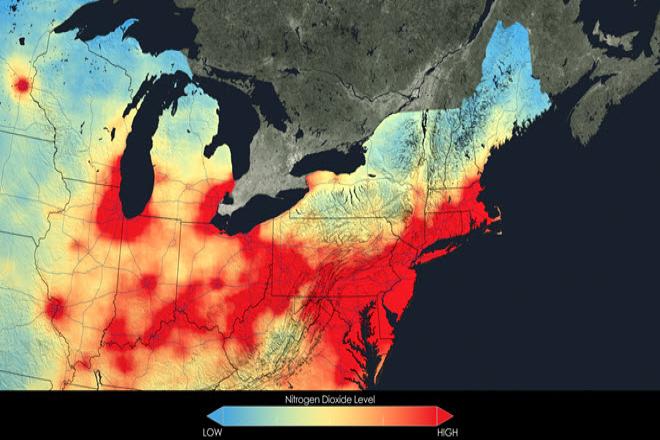
Credit: Close up of nitrogen dioxide in the Northeast U.S. averaged over 2005 by NASA is free to use.
Resource Description
In this data rich world, we need to understand how things are organized on the Earth's surface. Those things are represented by spatial data and necessarily depend upon what surrounds them. Spatial statistics provide insights into explaining processes that create patterns in spatial data. In geographical information analysis, spatial statistics such as point pattern analysis, spatial autocorrelation, and spatial interpolation will analyze the spatial patterns, spatial processes, and spatial association that characterize spatial data. Understanding spatial analysis will help you realize what makes spatial data special and why spatial analysis reveals a truth about spatial data.Geography of Water Resources

Credit: Landscape, Water, River, Sky, Lake 2239074 by Alexeev Alexey is licensed under CC0
Resource Description
Geography 431 is designed to further understanding of the natural processes of aquatic ecosystems, management of water resources, and threats to sustaining water quantity. Develop awareness and appreciation of the perspectives about water as a precious resource, commodity, and sometimes hazard. Learn how and why water is distributed unevenly around the Earth. Examine how resource management decisions are strongly related to water availability, quantity, and quality. The course examines water resources management; dams and dam removal; provision of safe potable water; threats to water quantity and quality; land use changes; the water economy; water laws and policy; institutions for water management at the global, national, regional, and local scale; and issues of water security and climate change.Geology of the National Parks
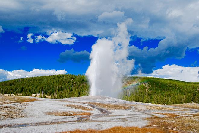
Credit: Geyser With Green Field Background by Damon Holle is licensed under CC0
Resource Description
Geysers and grizzlies and glaciers, oh my. The national parks may be America's best idea, saving the finest parts of the nation for everyone to enjoy forever. What better way to learn about the natural world than to tour the parks with us? We'll explore how the mountains and valleys formed and why they often come with volcanoes and earthquakes. You'll see what really killed the dinosaurs and how we can help save their modern relatives in the parks. With film clips, slide shows, and our geological interpretations of classic rock songs, isn't it time for a road trip?Geospatial Intelligence and the Geospatial Revolution
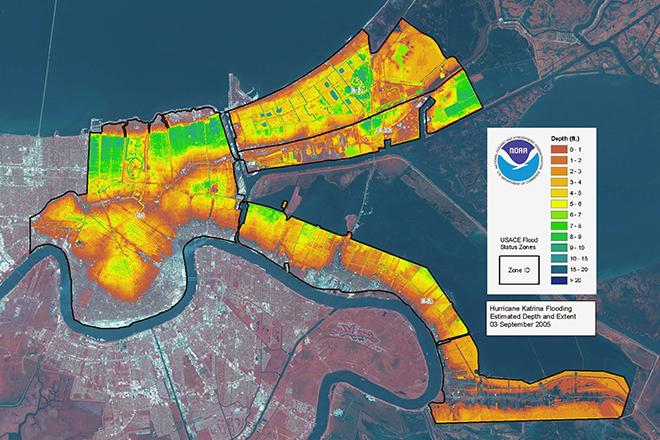
Credit: LIDAR map of New Orleans flooding caused by Hurricane Katrina, 3 September 2005 from ESA/NOAA is licensed under CC BY-SA 3.0 IGO