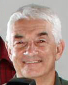
Ron Santini

Biography
So, who am I? I am an instructor for the Penn State World Campus and come to the World Campus from a different path than your typical instructor. I worked for 30+ years in the environmental field, 18 with a major southeastern United States energy utility. During my years at the utility, I was a project scientist and then a manager of a group of scientists and technicians responsible for the environmental assessment and monitoring of soil, surface water, and groundwater from utility discharges, waste ponds, ash basins, and landfills at fossil-, nuclear-, and hydroelectric-generating facilities. In addition, my team conducted environmental assessments for proposed overhead electric transmission lines, proposed generating facilities, and of contaminated legacy sites.
In 1994, I was part of an environmental exchange team that visited a nuclear-generating facility in Ukraine. The task of the team was to evaluate and make recommendations to the nuclear station management on how to improve station environmental protection programs.
I bring a unique online learning perspective to you. I was part of the first graduating class of the Geographic Information Systems Certificate Program offered through the Penn State World Campus. Having that under my belt, I enrolled in the online Master of Engineering in GIS program from the University of Colorado, Denver, and graduated in 2009. In addition, I hold an Master of Environmental Pollution Control degree, as well as a BS degree in biological health and an AAS. degree in business administration, all from Penn State. I am also a board-certified environmental professional, certified by the Academy of Board Certified Environmental Professionals.
