Geospatial System Analysis and Design
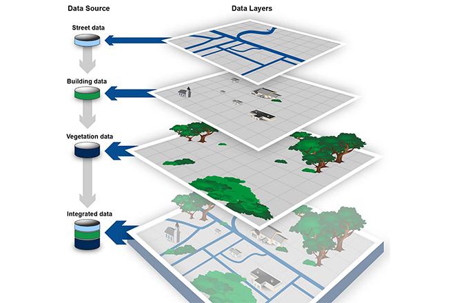
Credit: GEOSPATIAL DATA: Progress Needed on Identifying Expenditures, Building and Utilizing a Data Infrastructure, and Reducing Duplicative Efforts, from the U.S. GAO report, 2015 is Public Domain
Resource Description
Geospatial System Analysis and Design surveys the process of GIS design through critical reading/writing and collaborative discussion. Key topics in the course outline the broad range of current GIS systems, how they are designed and evaluated, and how emerging technologies may impact their design and implementation in the near future. In particular, students will develop a term-long project where they propose a realistic problem scenario that requires the skills and understanding required to effectively complete a geospatial system specification, design, and implementation. Students completing this course are able to develop a comprehensive system design plan that takes into account current technologies as well as emerging technology trends.
Course Number
GEOG 583
License
CC BY-NC-SA 4.0